 By
By
Many don’t know that the Land of Fire and Ice doesn’t just consist of volcanoes and glaciers. The same geological factors cause earthquakes as well. That’s why earthquakes in Iceland can be quite common.
Needless to say, when people find this out they have a lot of questions. This article is our attempt at providing you with the answers to some of the most frequently asked questions we receive about the earthquakes here on the island.
How Common are Earthquakes in Iceland?
Earthquakes in Iceland are as common as drinking coffee in the morning. It’s actually much more common than drinking coffee in the morning, since the number of earthquakes a day will put the number of coffees you have on a daily basis to shame. Because of the nature of the Land of Fire and Ice and the fact that geological ructions can cause all sorts of natural phenomena, seismic activity on the island is closely monitored.
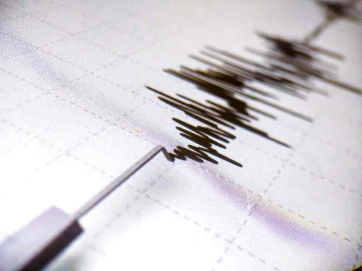
It is based on the data captured through this monitoring that we now know that Iceland experiences an average of about 26,000 earthquakes each year. That’s a rough average of 500 earthquakes each week. And... wait for it… 70 to 100 earthquakes every day!
It is important to note though that most of these are not the kind of earthquakes that will send books flying off the shelf and have you holding on to your fine china. In fact, most of these earthquakes rarely go above a magnitude of 2 on the Richter scale.
Why is Iceland Having Earthquakes?
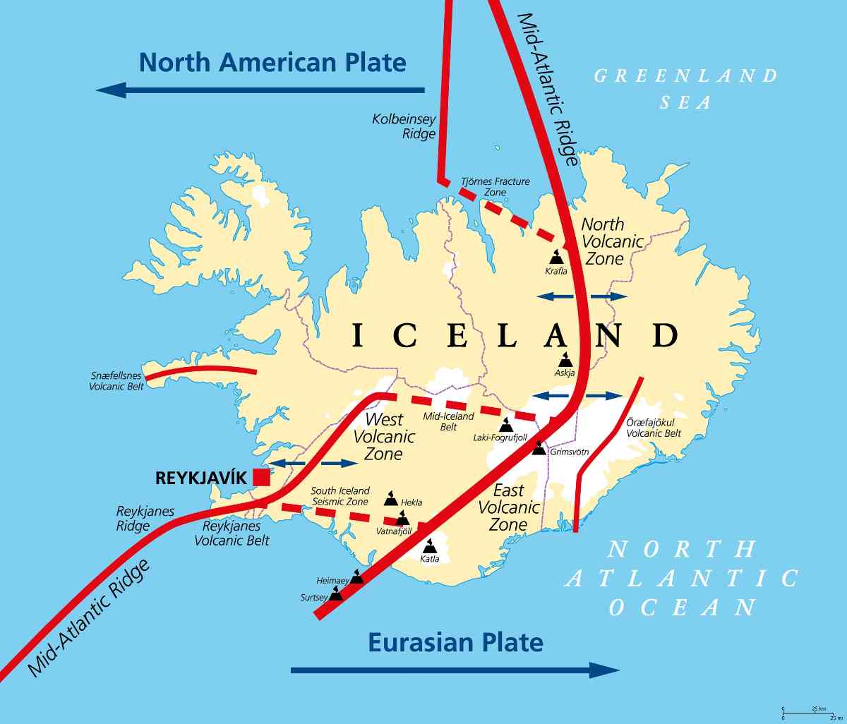
There are actually two reasons why there are so many earthquakes in Iceland, and, quite ironically, one reason feeds the other. Earthquakes in Iceland can occur because of the movement of magma (as you may already know, Iceland is a hotbed for volcanic activity). The other cause can be due to the movement of the tectonic plates (which is also what causes most of the volcanic activity here on the island in the first place).
Iceland also doesn’t have your regular once-in-a-while tectonic plate issues. The island is actually located smack-bang in the middle of a rift where the Eurasian and North American tectonic plates are actively pushing apart each and every day. This means that the volcanic activity and the earthquakes on the island won’t be stopping any time soon.
Where Do Most Earthquakes Occur in Iceland?
Based on the data captured through constant monitoring and the very reasons for earthquakes occurring in Iceland in the first place, most earthquakes occur in the areas right on top of the Atlantic Ridge (where the tectonic plates push apart) and wherever there is current volcanic activity happening.
When was the Last Time Iceland Had an Earthquake?
Based on some of our previous answers, it’s no surprise that the answer to this question will generally be “a few minutes/hours ago”. This is why any recent earthquake in Iceland is well documented, and all recent and past quakes can be viewed on an earthquake map of Iceland along with other information on the AllQuakes Earthquake Monitor site.
How Safe is it to Visit Iceland with All These Earthquakes?
As we’ve already mentioned, the majority of earthquakes here in Iceland are on such a scale that they can barely be felt. And even if one comes along that pushes that needle over a magnitude 2, as with the rest of the potentially dangerous natural phenomena here on the island – we are well-prepared for any situation.
This is also why all buildings must be able to withstand an earthquake with a magnitude of at least 7. And this is not a friendly suggestion if you just want to play it safe – this is according to legal building regulations and requirements. So you can rest assured that our structures can take a few punches and that magnitude 2 won’t have your accommodation imploding around you.
What Should I Do During an Earthquake in Iceland?
If you come from a place where earthquakes are a rare occurrence, the following tips and advice will help:
- Stay calm! No good has ever come from hysterics. In fact, many of our “earthquake injuries” here on the island are caused by the people themselves as they scramble in a panic to get out of the house. And always remember that once you feel that tremor, the odds of it ever-increasing to really dangerous levels here in Iceland is next to nothing. Our earthquakes also tend to be very short-lived and generally last just a couple of seconds.
- Steer clear of any shelves that have things that can fall off them. It might just be a little tremor, but if that big vase on the top shelf lands on your head, you’re not going to be happy. The same rule of thumb applies if you’re outside; try to avoid any area where loose roof tiles can fall and hurt you.
- Steer clear from windows. You don’t want to risk finding out what would happen if the glass should shatter.
- If the earthquake lasts longer than just a couple of seconds, or you can feel this is much more than just another little tremor, it’s best to get into a sort of brace position. This consists of kneeling down under a sturdy table or in the corner of a load-bearing wall whilst covering your head.
- Save Iceland’s emergency number (112) in your phone, so you can rest assured that if push comes to shove, help is just a phone call away.
Earthquakes in Iceland; Nothing to Fear
As you can see, the earthquakes here in Iceland are nothing to fear and definitely won’t inspire the next apocalyptic movie scene. You can also rent a car in Reykjavik and start your road trip with the peace of mind that the earth won’t tear open with the first tremor and swallow you whole.
In fact, you might actually confuse the earthquake with the car’s engine running and simply carry on with your Iceland adventure without even knowing that you’ve experienced one of our earthquakes. So, don’t let irrational fear keep you from the holiday of a lifetime, and rest assured that you can travel through the country safely.